The different activities of operational oceanography can be grouped into three main blocks:
ICATMAR measures waves, sea level, sea currents, salinity and sea temperature in the coastal strip between the Catalan coast and 40 nautical miles (about 74 km). These measurements are processed and distributed as quickly as possible in order to be useful in various fields, such as maritime rescue tasks. These data are also used to improve wave and current forecasts. At ICATMAR, we use two types of numerical models to make predictions: wave models and ocean circulation models to predict currents. Since waves generate currents and currents modify waves, these two models are used together. Finally, we combine these data obtained with data obtained by other agencies such as the European Space Agency, to monitor how sea temperature evolves with climate change. Among the most useful tools for disseminating all the generated information are the different viewers that have been developed.
Fixed observation instruments: tide gauges and moored buoys with oceanographic instruments that measure temperature, salinity, currents, waves and atmospheric variables.
Drifting buoys: ARGO buoys that cyclically record and transmit salinity and temperature data, CODE buoys that measure ocean current velocity at 1 m depth, and SVP buoys that measure ocean current velocity at 15 m depth.
High-frequency radars: radars that use radio waves to measure surface currents in the coastal strip between the Catalan coast and 40 nautical miles (about 74 km). They can also measure waves.


In addition to these instruments, we use data from oceanographic satellites. The use of satellites allows us to observe large areas of the sea at the same time, although the measurements are restricted to phenomena that occur or are reflected on the sea surface.
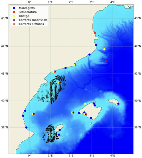
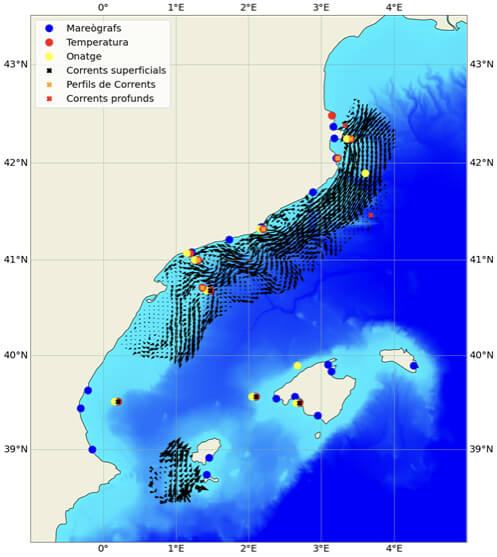
On the left, observations available in 2022, before the start of the deployment of the ICATMAR network. On the right, observations that will be available once the ICATMAR network is fully deployed and operational, in early 2025.
Observations: measurement of physical variables of the sea (temperature, salinity, waves and current velocity) at certain points in Catalonia. These data are updated instantly and are accessible indefinitely.
Analysis: present or past estimations of these physical variables by combining simulations and observations at all points in Catalonia. The analyses are updated daily.
Forecasts: future estimations of the physical variables of the sea based on simulations at all points in Catalonia. The forecasts are updated daily and are accessible until the next forecast arrives.
The information provided by the observations and models is processed to generate value-added products that are delivered to the different users in the shortest possible time.
ICATMAR data are publicly available. You can visit our data viewers to explore them or download them from our data distribution services.